Salmon Leaps walk

Salmon Leaps is a nature spot near Michaelston-le-Pit. I discovered it a couple of weeks back during a 54km hiking loop, which took in some of the Wales coast path from Cardiff Bay to Sully, Dinas Powis woods and castle, Salmon Leaps, Tinkinswood Burial Chamber, and St Fagans. You can watch the video which I created about that day at the bottom of this post.

I've since been back to Salmons Leap via a shorter route - so I thought I'd share that with you here (unless you want the 54km version??)

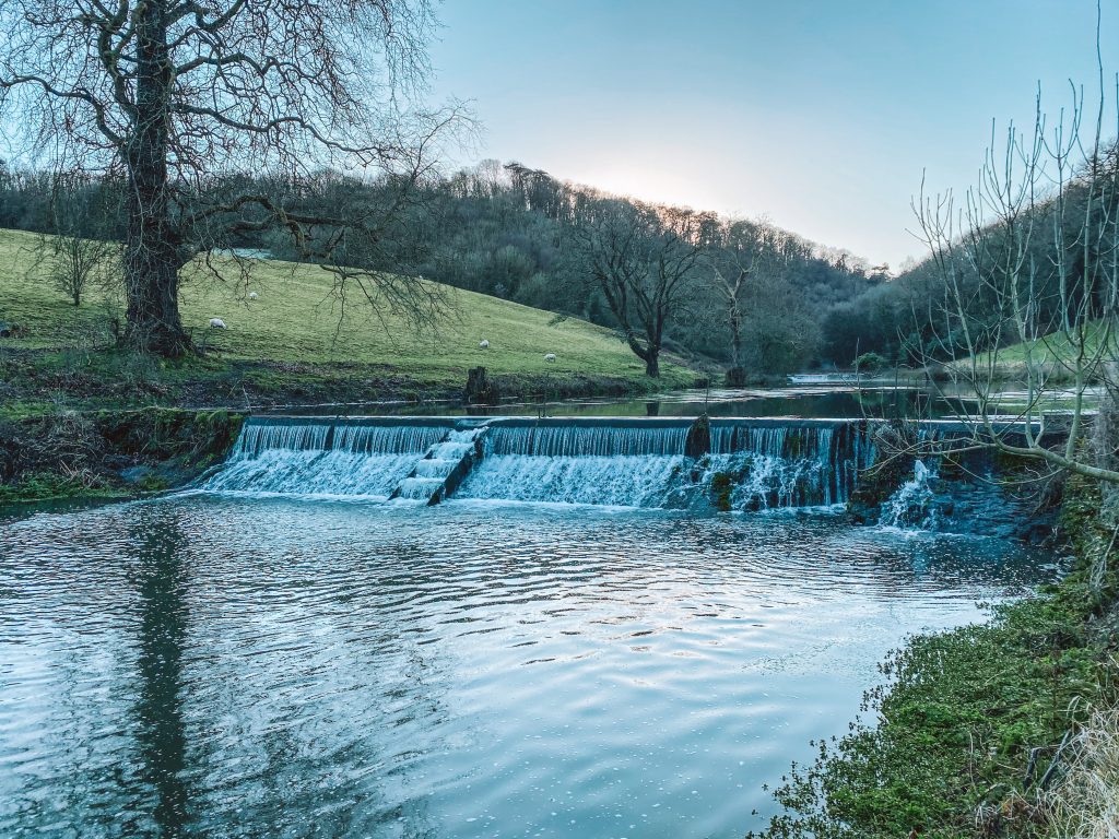
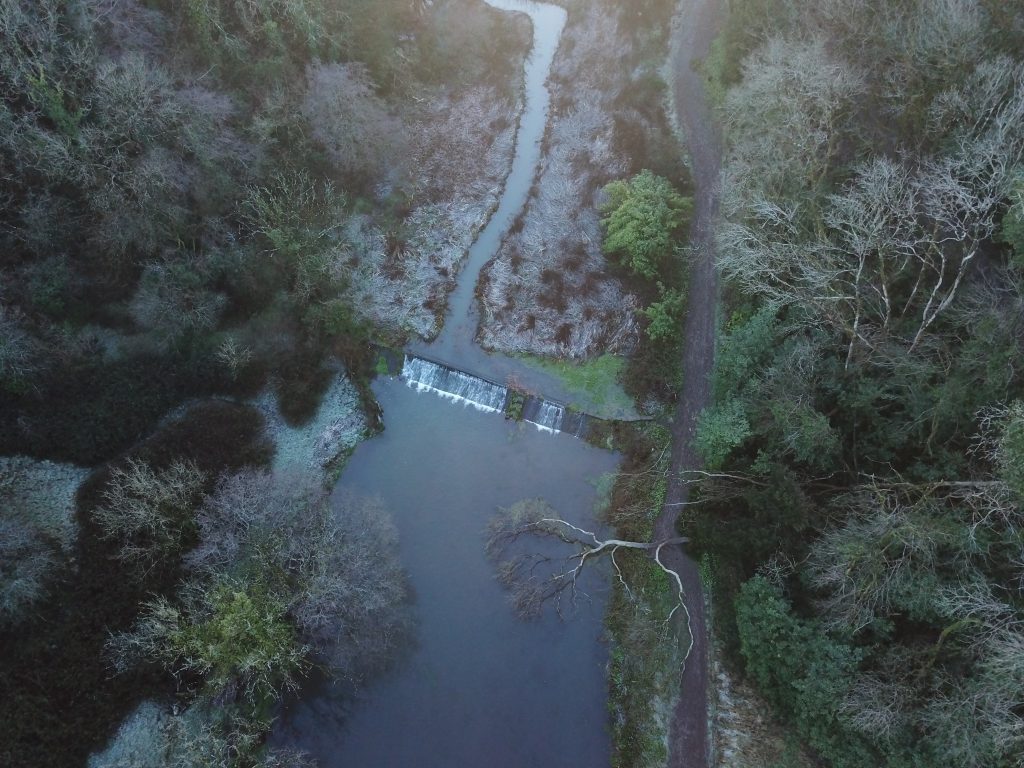
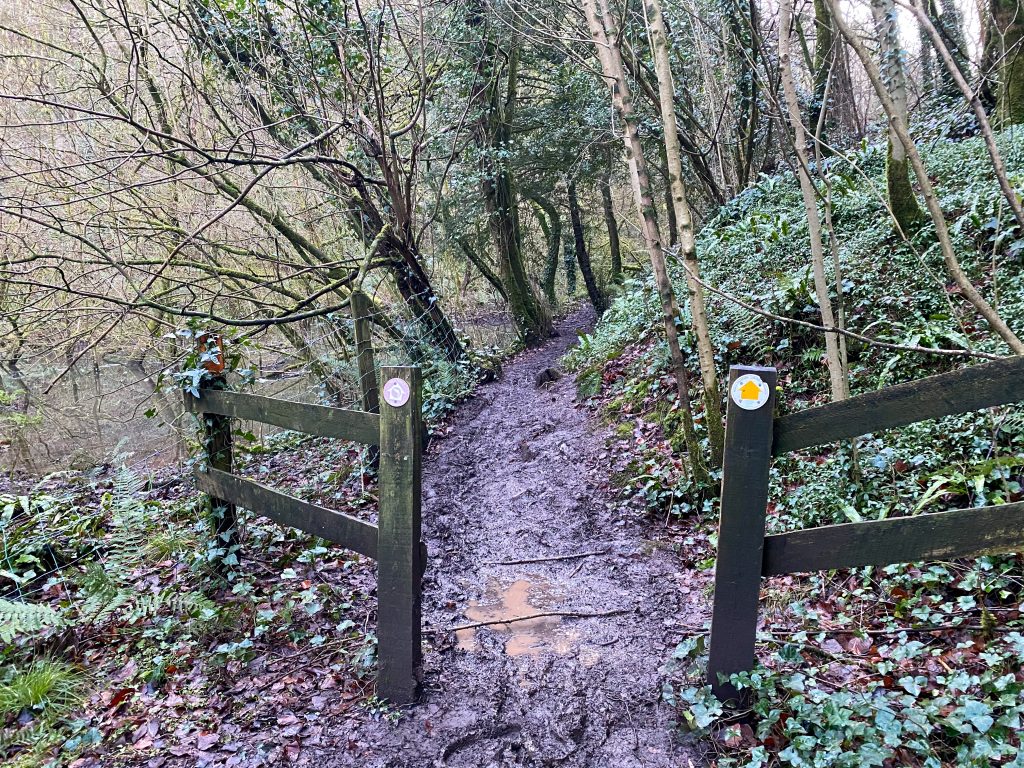
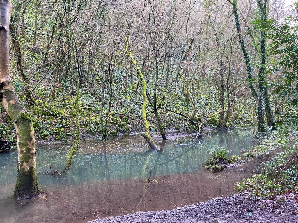
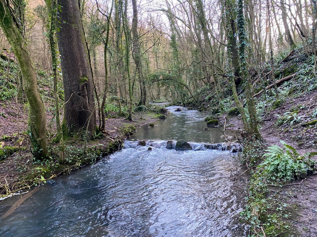
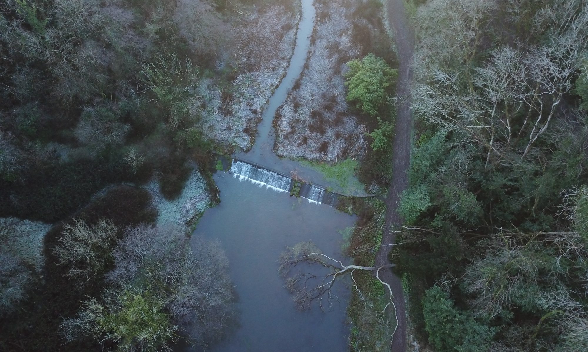
I'd describe Salmon Leaps as a magical little wooded valley, with a chalky blue stream and pools that look full of wildlife. The pools link together via cascading steps. It's only accessible on foot, and at this time of year (winter) is very (very, very, very) muddy. So boots or wellies are advisable!

Route

The route is just short of 15km when starting from Cardiff Castle. It takes you up through Leckwith Woods, which is very muddy and steep (so get your grippy shoes on), but good fun. If you don't live in Cardiff Castle then you'll obviously need to adjust your start point accordingly. Here's a downloadable GPX file for the route:

Alternatively, you can use the link below to view the route on the OS maps site. I use my OS maps app to plot all of my routes. If you have a subscription you can save it – if not then you will still see the route for free, but in order to save/download it and follow it via the app, as well as change to an OS map (instead of standard map) view, you’ll need to have the OS app. This is an affiliate link so if you choose to subscribe I’ll get a wee tip. It’s honestly the most affordable way to get OS maps of the entire UK at your finger tips – and has been a life saver for me in lockdown.

Link to OS map: https://tidd.ly/36Ubkam

Adventures in Lockdown: Cardiff 3 Peaks

Garth Hill

Cardiff 3 peaks? What the hell is that?

It has similarities to the National 3 Peaks challenge, in that, there are 3 lumps which stick up from sea level and you walk over them. But, that's about it. It's roughly a 34km loop, starting and finishing in the centre of Cardiff (other start and end points are available if you don't live in Cardiff Castle - obvs).

Um, why?

At this point in time we're in lockdown 3.0. This time around I've decided to accept it. Rather than having a constant narrative about how unfair it is streaming through my head, I've chosen to live by one of my favourite sayings - 'it is what it is'. And do you know what... it feels great. It's freed me to enjoy the things that I CAN do within the restrictions, and to be creative with my time. I took a hike a couple of weeks back, and named it the Cardiff 3 Peaks. Then I thought "hmmmm, other 'Cardiffians' might want to know about this". And here we are.

Highlights

Definitely the sunrise on Garth Hill - if you can get yourself there when the weather's right, it's so worth the early start. I could see the sun reflecting on the Bristol Channel. It was beautiful.

Other highlights include; the woodland on the way up to Garth Hill, my epic snacks (can't guarantee that for you), a splatter of snow on Craig Yr Allt (again, not guaranteed), and getting stuck in a sea of brambles by Caerphilly common and making it out alive!

Where's the route at then?

Download the GPX file to use my route via some fancy GPS device:


Alternatively, you can view the route via OS maps: Cardiff 3 Peaks

The above link allows you to view the route for free on a standard map view. If you have a subscription, you can change to an OS leisure map, and save the route to access fully from your phone.

If you don't have an OS maps subscription, this is the part where I convince you it's amazing, because it is, I love it, and also because I'll get a wee bonus if you love it too (what can I say, these blogs don't pay for themselves).

I highly recommend it - it's an incredibly cheap way to have access to OS maps of the entire UK on your phone and laptop all year round. You can plan and edit routes on several different map views, as well as watch 3D fly through's of your routes - so you get an idea of the landscape before you go! I've been using it for about 4 years, and used it to plan and visualise (with the fly through) every section of the entire 477km route for my Ultimate Wales challenge. It's honestly one of my most used apps!

*The link is an affiliate link, so if you decide to subscribe to OS maps (like I do), then I will receive a wee referral bonus. 

Route variations

Obviously there are a million different ways to skin a cat (hate that saying - no one should be skinning cats), but a couple of my suggestions for route variations would be -

From Caerphilly Common, head back to Cardiff via the Wenallt instead of Graig Llanishen.

And, if you're not racing up Garth Hill for sunrise, there's a lovely little nature reserve between Garth Woods and Garth Hill that's worth a wonder through - you'll spot it on the OS map!

Coed Rhiw'r Ceiliog
Garth Hill
Sun rising from behind Garth Wood and the quarry
View from Garth Hill - great spot for a coffee and sunrise stop!
Snow dancing on Craig Yr Allt (there were tiny specks) - you can just see Garth Hill behind my noggin
See those snow specks?? - Looking back along Craig Yr Allt towards Garth Hill in the distance
Caerphilly Common (the third hill) - looking back towards Craig Yr Allt and Garth Hill in the distance